.
Pre 1814 - Pennar
Before 1815, the site of modern Pembroke Dock and its nearby settlements was mostly
farmland. A small hoard of Roman coins found at Pennar suggests local farmers trading with
Romanised Carmarthen. In 1595, shellfish from the oyster beds at Pennar Mouth were known to
be particularly "bigg and sweet". "The choicest oysters" were still being fished there in 1897.
The name Pennar ("headland") is Welsh. Like Llanreath and Llanion, it dates from before the
Norman invasion of 1093.
Some early shipwrights, rowing back and fore from Milford, would land at Pennar Point then
walk via Llanreath to the Dockyard. One of this route's attractions was the Dolphin at Llanreath
Point. Publican Mr David Price lived to be 96, remembered marking out the Dockyard site in
1813, and sold beer "wisely diluted" - thereby avoiding fights on his premises.
(Sources: Hughes, Pennar 1-2, 5; ; PT 22 Jul 1897; Charles 723; Mason 16, 33-4)
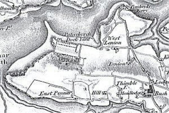
Paterchurch Dock Yard, 1819. The O.S. map shows
the older settlements of Pennar, Lanion, Pembroke
Ferry, Hill and Imble.

Pre 1814- Llanion
Scholars suggest Llanion may be the Welsh Lonion / Llonyon, where bees were kept, and
where a church associated with St. Teilo stood. The Meyrick family owned the substantial
country house at Llanion in the eighteenth century, sometimes living there and sometimes
letting it out. By 1810 it is "till of late years inhabited by a succession of tenants but ... now
unroofed and suffered to fall into decay" as nearby Bush became "the principal family
residence".
Sir Thomas Picton visited the area in 1815, recruiting soldiers. After his death a few months
later, part of Llanion was renamed in honour of this popular general's last battle - Waterloo.
Fig. A tree lined avenue led from Ferry Lane to Llanion House. The garden wall, and ruins of
the mansion, still stand.
(Sources: Jones, Francis, 145 ; Hill 1; McGarvie 36-8; Hogg, Lost PD "Old manor..." ; Fenton 198; Mason 26)
Picture by courtesy of: Pembrokeshire Record Office

Pre 1814 - Pembroke Ferry
Pembroke Ferry provided the quickest crossing between the Medieval strong points of Pembroke and
Haverfordwest. "The Passage" of Pembroke's first charter (c 1180?) is by 1324 named "Penebroke
Fferre".
The wooden ferryboats could carry substantial payloads. In 1500, the ferrymen had to agree to pay
for damage if they failed to provide straw protecting the boat's planking against heavy loads of
timber and stones. In 1897 the boat could hold two men (rowers) and 19 Llangwm women,
complete with their goods for sale in the market.
Lord Cawdor and the Castlemartin Yeomanry crossed here in February 1797, hastening to repulse
the French invaders at Fishguard. That August, the Yeomanry stood guard while 200 captives were
rowed out to their prison ships. As the escort watched from Pembroke Ferry, a grateful French
soldier "whose life Lord Cawdor had saved from a Welshman's blow, pulling off his hat, made two or
three bows".
In 1834, rates at Pembroke Ferry were "one halfpenny for a foot passenger, one penny for a man and horse, and one shilling per wheel for carriages". By that
time, rival ferries were carrying traders and workers to the new dockyard town. Mr Huzzey of Pembroke Ferry lost a complicated law case to protect his
business, and his opponents at Neyland celebrated with bonfires and fireworks. Rowboat ferries now landed at Front Street and Hobbs Point, where steam
ferries also began running.
Pembroke Ferry operators sometimes took a relaxed attitude to their duties. In 1772, John Wesley noted "The watermen were not in haste to fetch us over".
He sat on a stone and read while waiting. As late as 1903, ferrymen were not inclined to rush their leisurely lunch at the Ferry House Inn for the sake of a
solitary passenger. Today, travellers cross near the old route - but by car, and using the Haven Bridge high above the original boat's course.
Some 19th shipbuilding took place in the Pembroke Ferry area where, in 1855, the coaster Pilot was launched at Mr William Allen's yard.
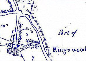
Nearby Kingswood and Bangeston appear in Medieval farm accounts. "Kingswood" may come from a time when the Earldom of Pembroke was in the hands of
the Crown, while Bangeston derives its name from its early occupants, the Benger family.
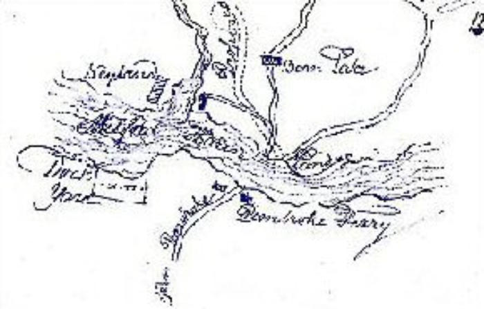
Pembroke ferry, c. 1820. The new dockyard is to
the west of the old road from Pembroke to the
Passage.
(Sources: Charles 722-3, 729; Owen 83, 115, 176; Mason 90-91, Lewis 1834.; PDG 23 Jul 1897; Salmon 194; Williams, Wesley, 87; Johnson, Ferryboat ahoy;
HMT 30 May 1855)
Picture by courtesy of Pembrokeshire Record Office

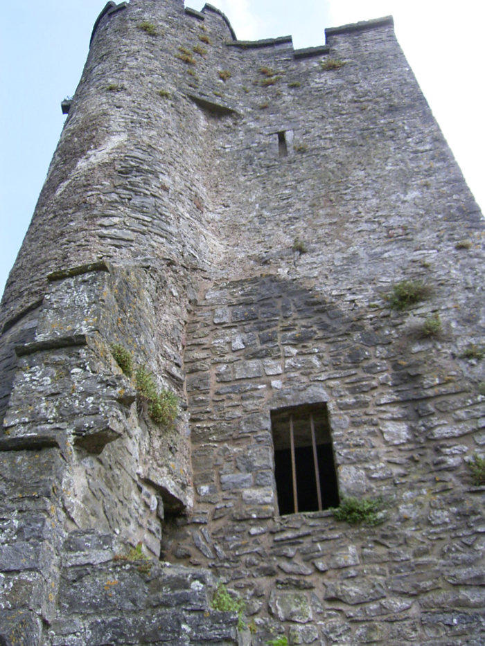
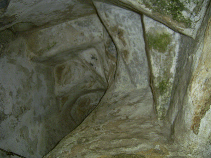
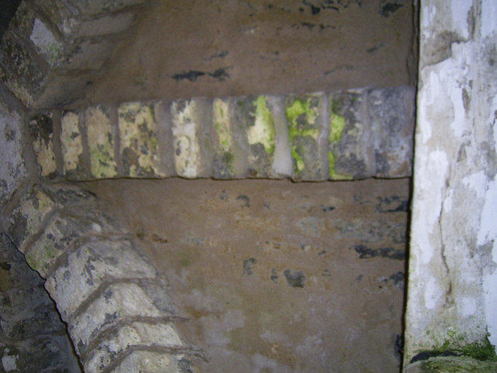
Paterchurch is first mentioned in 1289. The medieval tower, like nearby eighteenth and nineteenth
century fortifications, may have served as a lookout post. The rooms have fireplaces, and a connecting
spiral staircase.
By the seventeenth century, additional domestic and farm buildings stood close by. In 1698, goods and
livestock included furniture, kitchen equipment, cows, oxen, horses, lambs, sheep, pigs, geese, ducks,
poultry, wheat, barley, oats and ... a violin. The tower now lies within the Dockyard wall, whose
builders in 1844 unearthed numerous skeletons - the isolated settlement had its own cemetery, whose
last recorded burial is that of Roger Adams, in 1731.
Paterchurch Tower was the centre of an estate said to stretch from Pennar Point to Cosheston. This
changed hands in 1422 when Ellen de Paterchurch married John Adams.
Before the Dockyard was thought of, various sales and exchanges took place between the principal
local landowners - the Adams, Owen and Meyrick families. These left the Meyricks in control of most of
the land on which the Dockyard and new town were to develop.
By 1802 the Paterchurch buildings were ruins. Although the Adams family had moved to Holyland near
Pembroke, they maintained links with Pater. General Adams, in 1833, recommended that the
Defensible Barracks be built. In 1862, a Miss Adams married Captain Loring, Captain Superintendent of
the Dockyard.
(Sources: Charles 723; Tiffany; Mason 18-19, 21, 51-4, 70-1)
Pre 1814 - Paterchurch
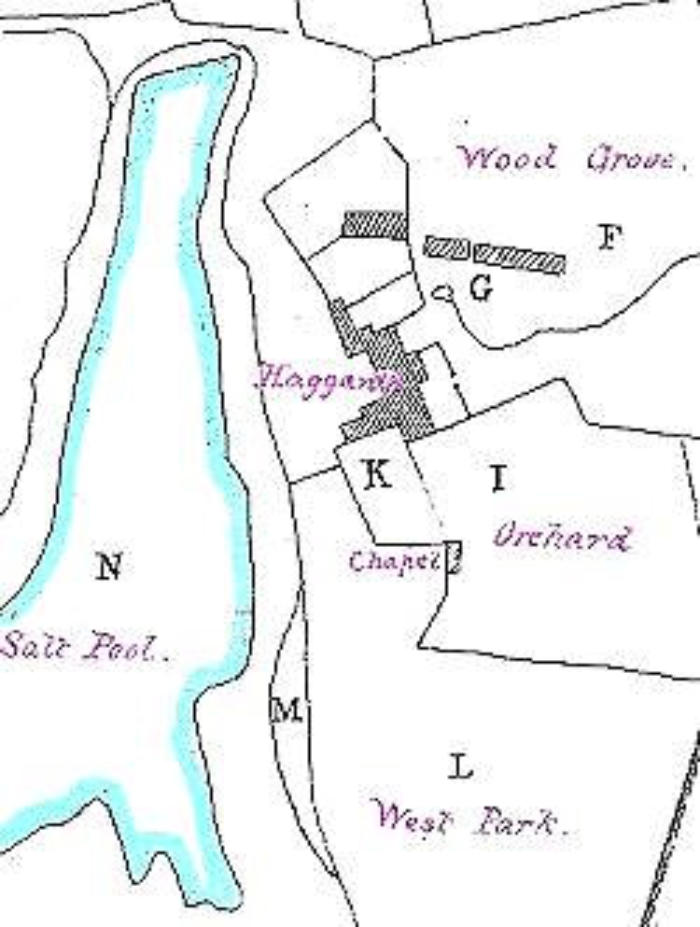
Paterchurch Tower was surrounded by farm
buildings This old map includes a "chapel".
The natural "salt pool" was near today's
Dockyard pickling pond.

Pictures from Moonlightblue Community Services
Pre 1814 - Farms
A few farms and scattered smaller houses completed the area's early settlement.
The massive
Pennar farmhouse still stood "like a fort" in 1905. It was already several hundred
years old.
Bierspool, now demolished, stood near today's London Road traffic lights. Bierspool
Farm had its own dovecot and horse-driven machinery. Paterchurch Farm was
opposite the top of Cumby Terrace until 1844. It was also known as White's Farm
after its tenants - a family descended from Thomas Whyte, the Tenby mayor who
had helped save Henry Tudor's life in 1471. Imble and Mead Lodge farms are still
beside the old shore track to Pembroke.
(Sources: Mason 23; Hogg, Lost PD)
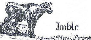
Milking time at Imble farm, c. 1780.


TOP
HOME
(Amendment, updates and additions) (AJ) Anndra Johnstone
This site is designed, published and hosted by CatsWebCom Community Services © 2018 part of Pembroke Dock Web Project